Monument Valley, Arizona and Chaco Canyon, New Mexico

Sunday May 12-Tuesday, May 13

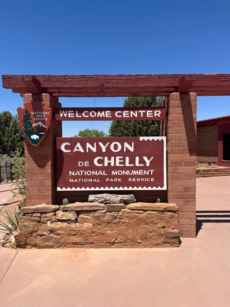
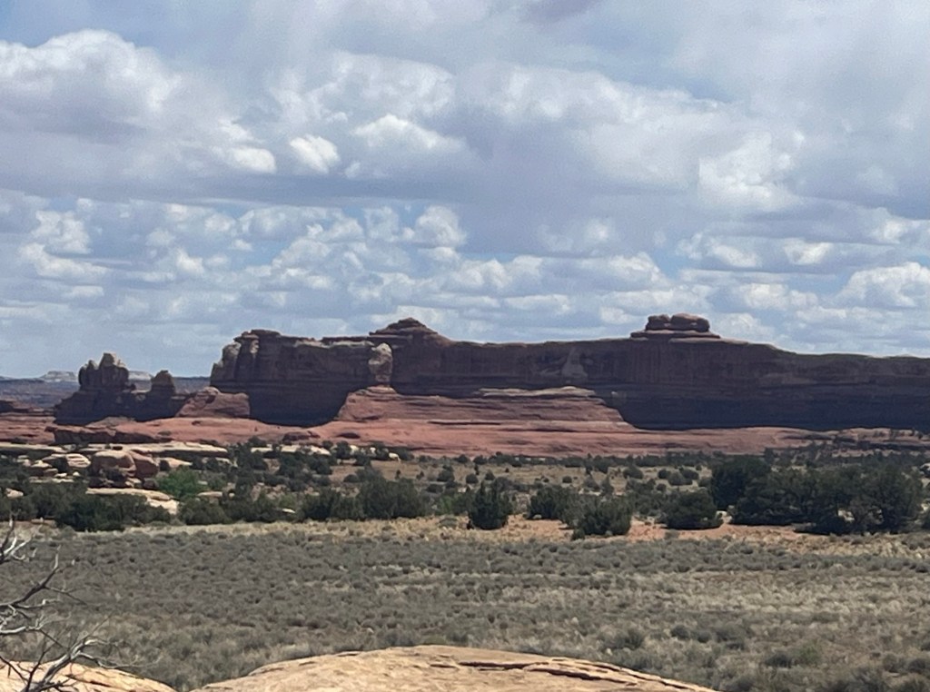
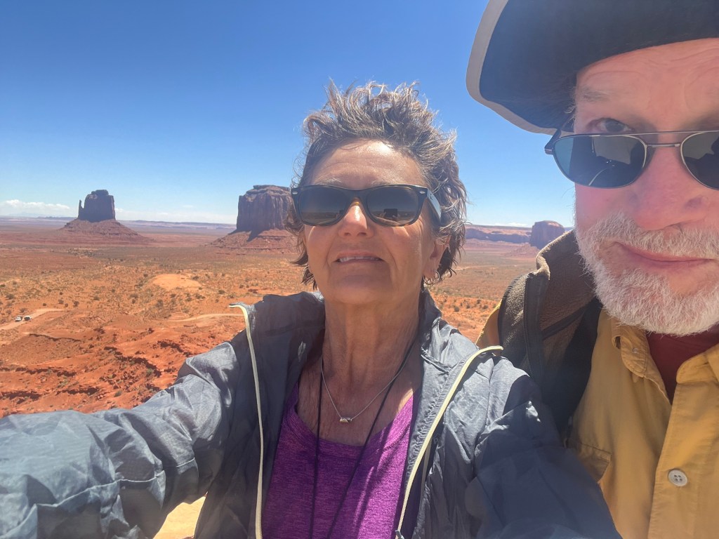
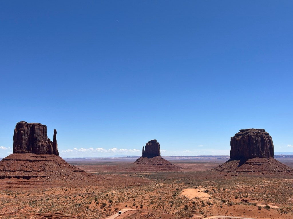
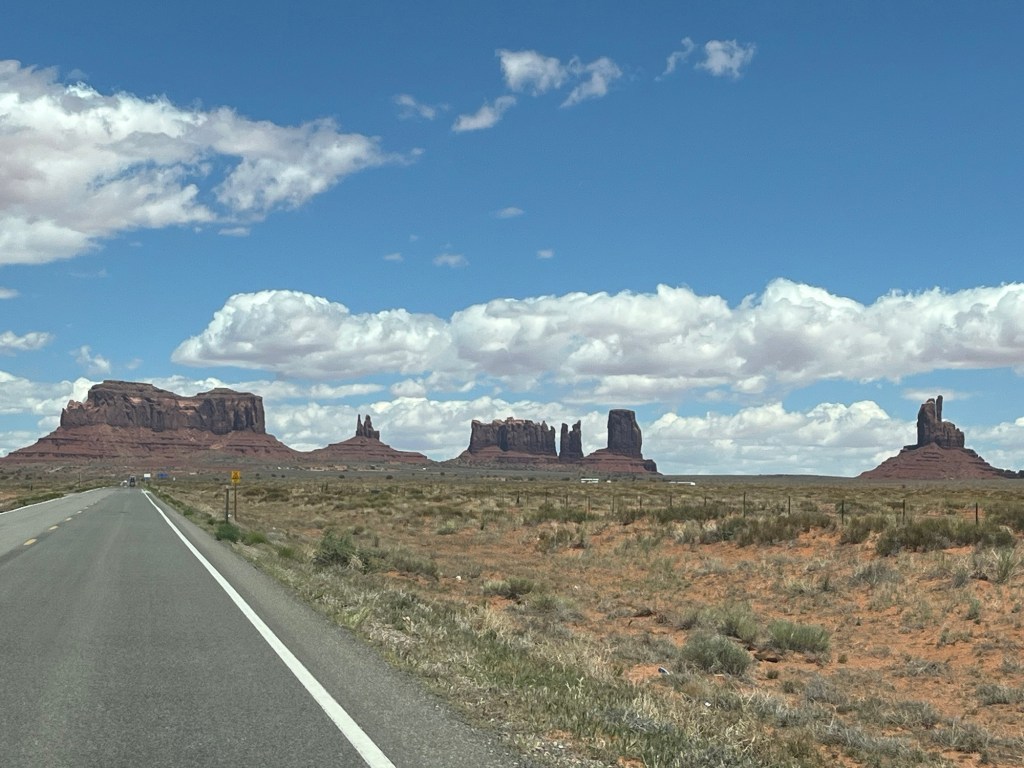
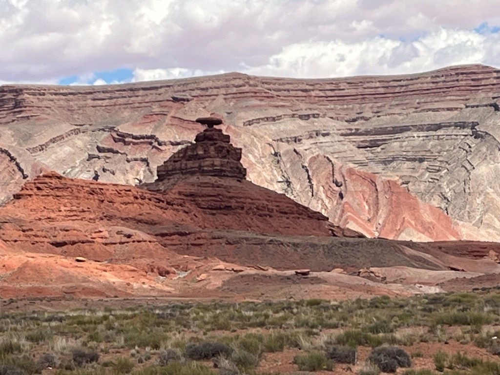
It’s a short drive from our campsite at Canyon de Chelly to Monument Valley Navajo Tribal Park, which is said to be one of the most photographed places on earth. It is quite impressive, to be sure. The visitor center is swarming with tourists and features a rather tacky gift shop.

It’s really windy and we’re bad at selfies!

We go down the road to the Navajo Nation visitor center and find a market with vendors selling art made by Navajo and Zuni makers. We had a pleasant conversation with Raymond Valento, a white man married to a Navajo woman-he’s been representing Zuni and Navajo potters, jewelers, sculptors and weavers for over 60 years. We bought some jewelry, of course! Andy picked out a little bear fetish made of jasper as a possible stand in for Buzz Roadkill (nothing can replace him!). These animal carvings have symbolic meanings-in the Zuni tradition the bear guards the West. It is more correct to call these objects carvings rather than fetishes, because they have not been blessed by a shaman.

More car shots as we traveled to our next destination. This is Mexican Hat Rock.
Unbelievably beautiful!

We spend the night in a motel in Farmington, NJ. We meet a couple from Hancock, Maine! We encounter people from Maine everywhere we go.

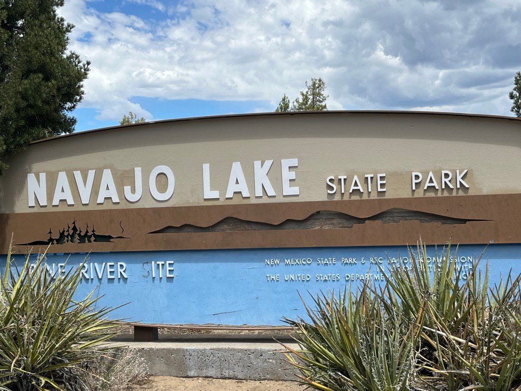
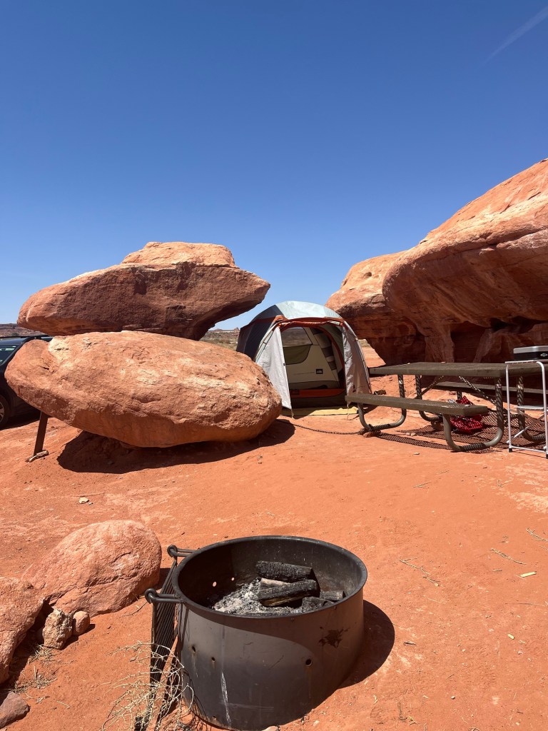
On Monday, our next campsite is a huge state park with several campgrounds and a large marina.

Our campground is Crusher Hole-almost completely empty. There are so many birds here! My Merlin app identifies several species by sound, but they are difficult to sight. We do see ospreys passing overhead with fish in their mouths.
This is supposed to be one of the best trout fishing areas in the country. The sunsets are awesome!
Monday, we make a day trip to Chaco Culture National Historical Monument. Our tour guide at Canyon de Chelly told us stories of the people who lived here, and we were inspired to visit. In keeping with the theme of our trip, access to this site involves 20 miles of washboard gravel road. I think some of my teeth are getting loose!
Chaco Canyon was a cultural center for the Ancestral Pueblo people who lived here from 850 to 1250CE. It served as a hub of trade and ceremony for many peoples who gathered there. This place is central to the origins of several Navajo clans.
The great houses of Chaco were constructed during the 800s. They were oriented to solar, lunar, and cardinal directions. Sophisticated astronomical markers, communication features, water control devices, and formal plazas surrounded them.
A system of roads connected more than 150 great houses throughout the region. These were not heavily populated villages but may have been used more for ceremony and trading and as impressive examples of “public architecture.” Wood used in their construction would have been hauled by hand from over 50 miles away.
Roy took us on a tour of Pueblo Bonita, the largest of the great houses. The public is allowed to follow trails that go around and inside these dwellings.
Roy led us through a succession of small doors into small rooms.
These corner windows were built to serve as astronomical markers. Two face east and are called solstice windows because they were used to view the sunrise on the winter solstice.

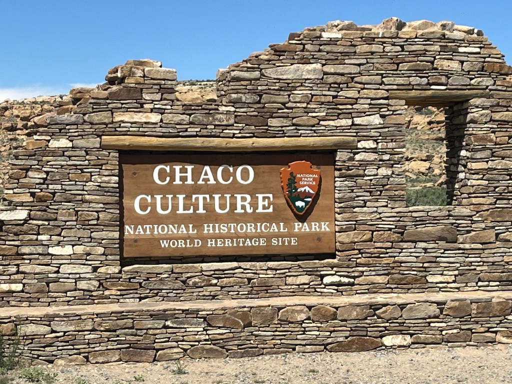
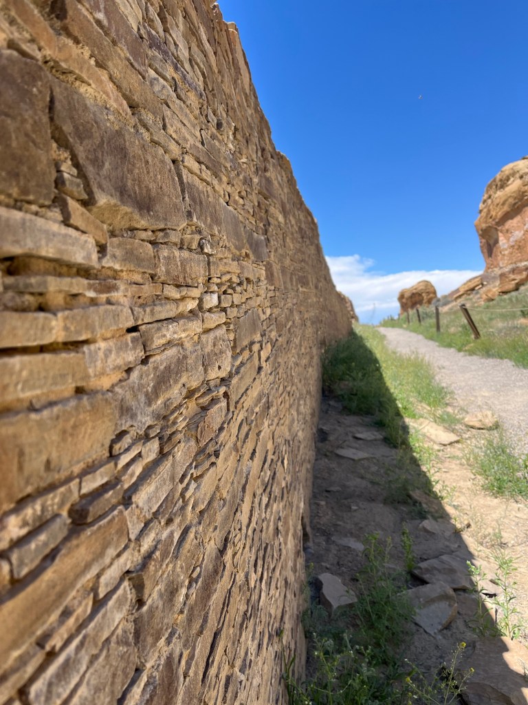
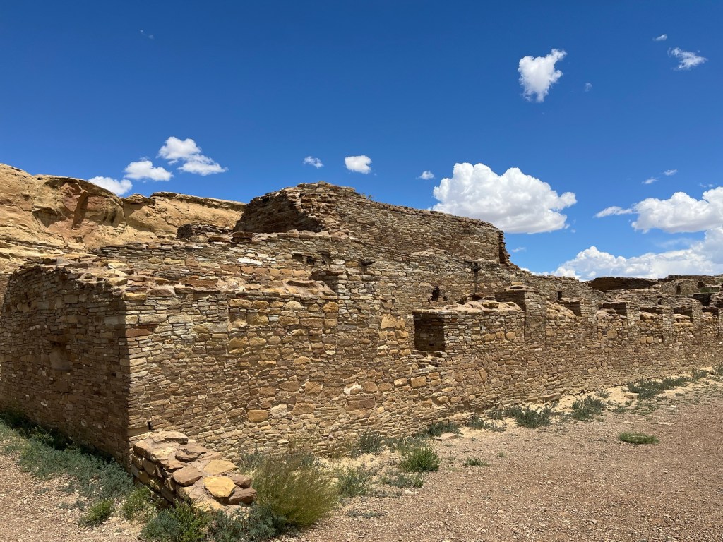
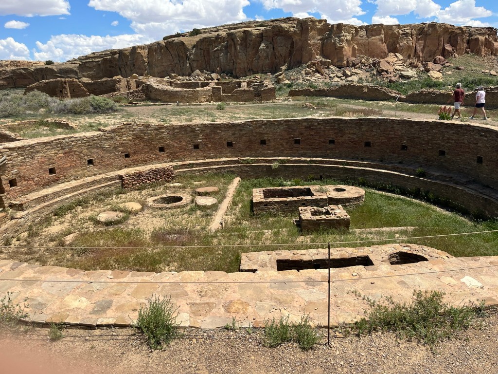
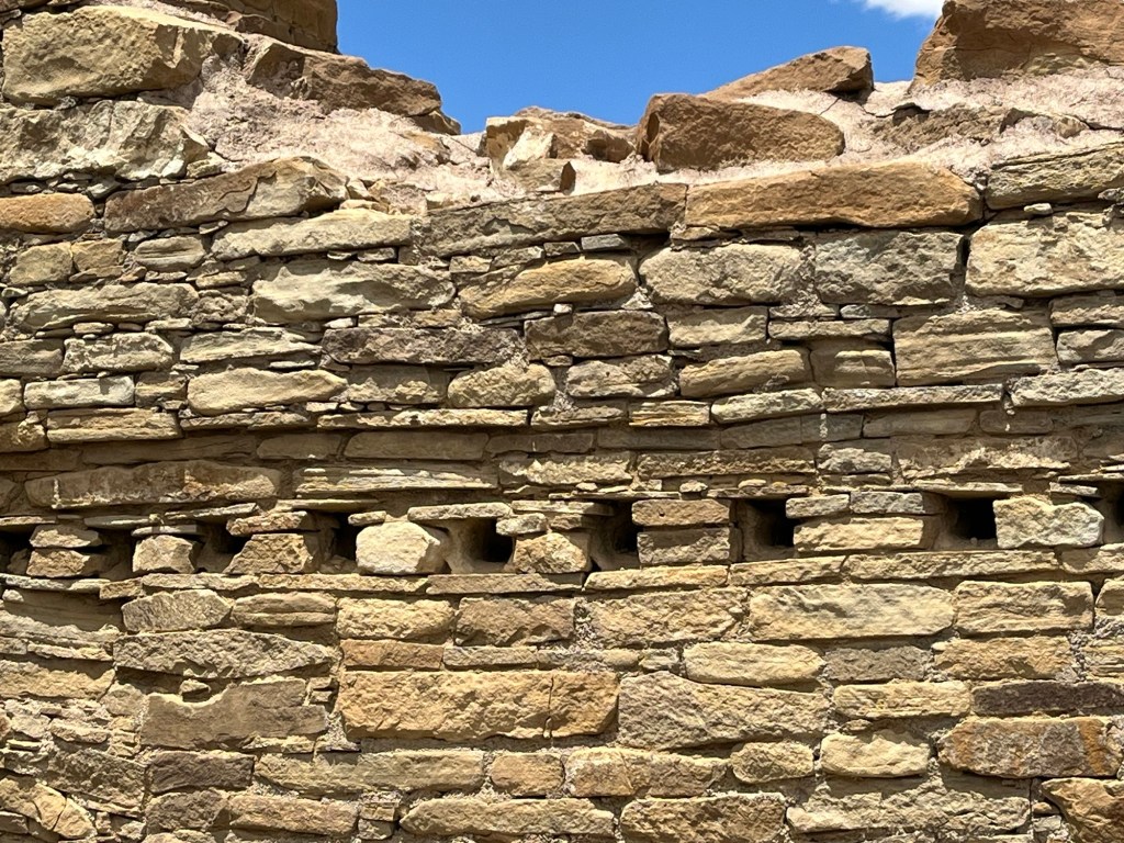
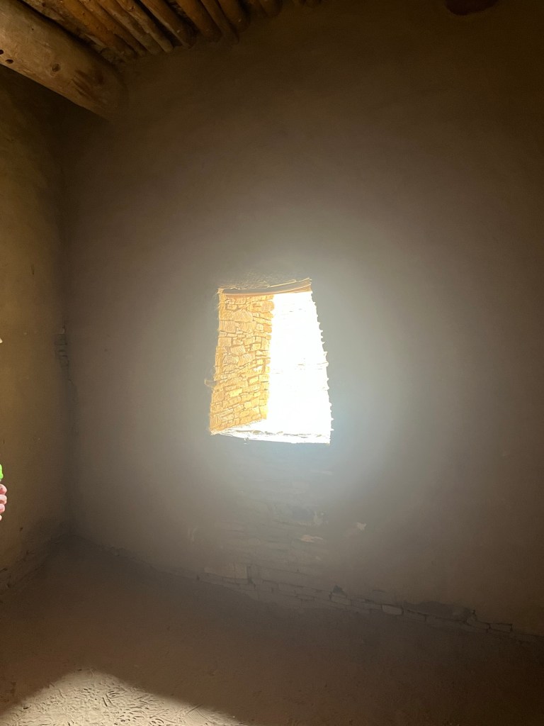
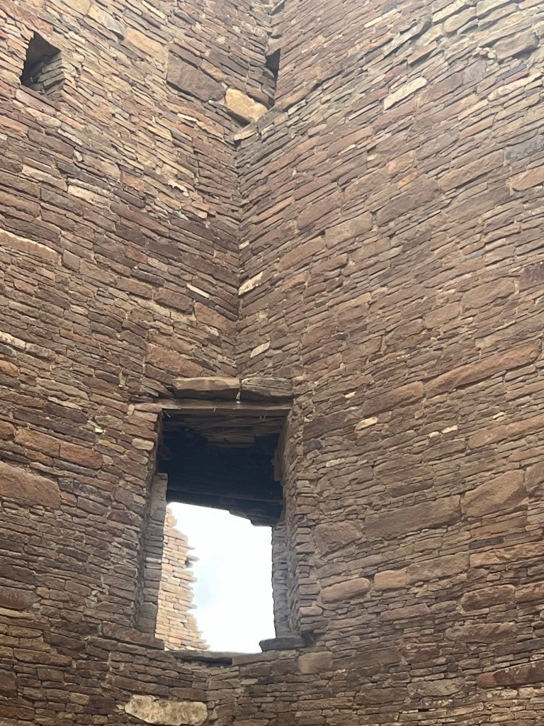
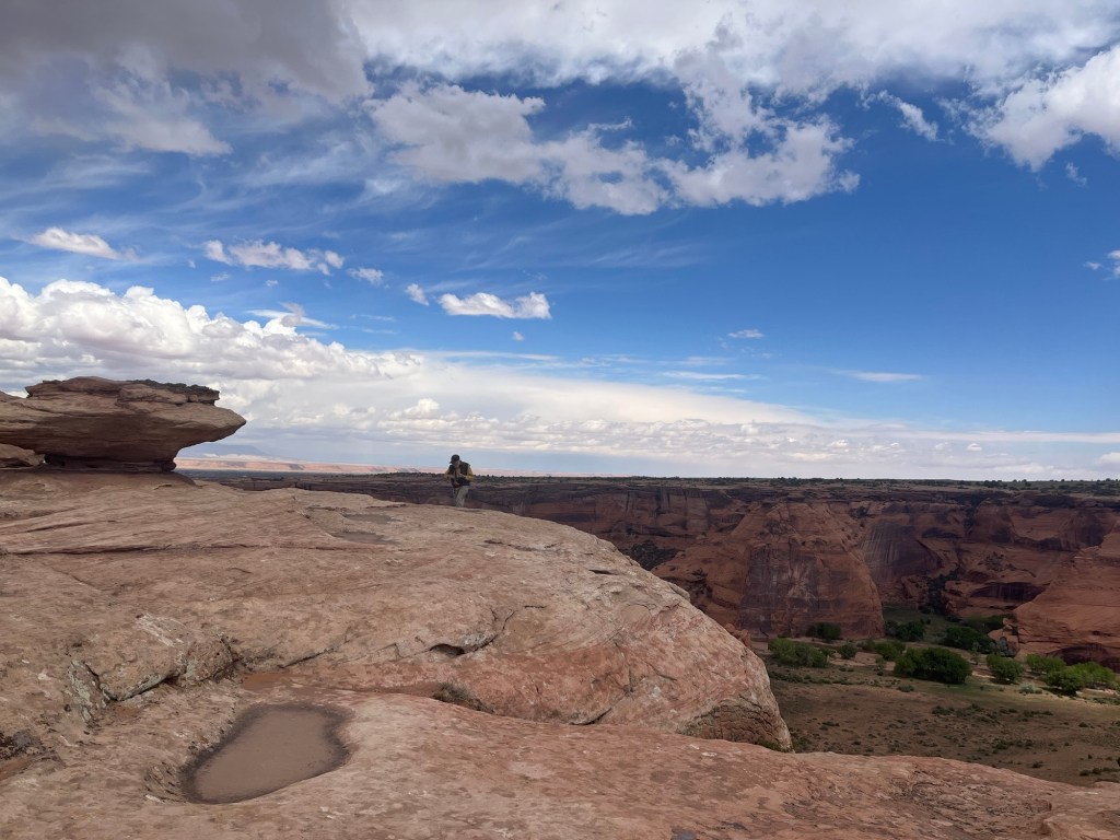
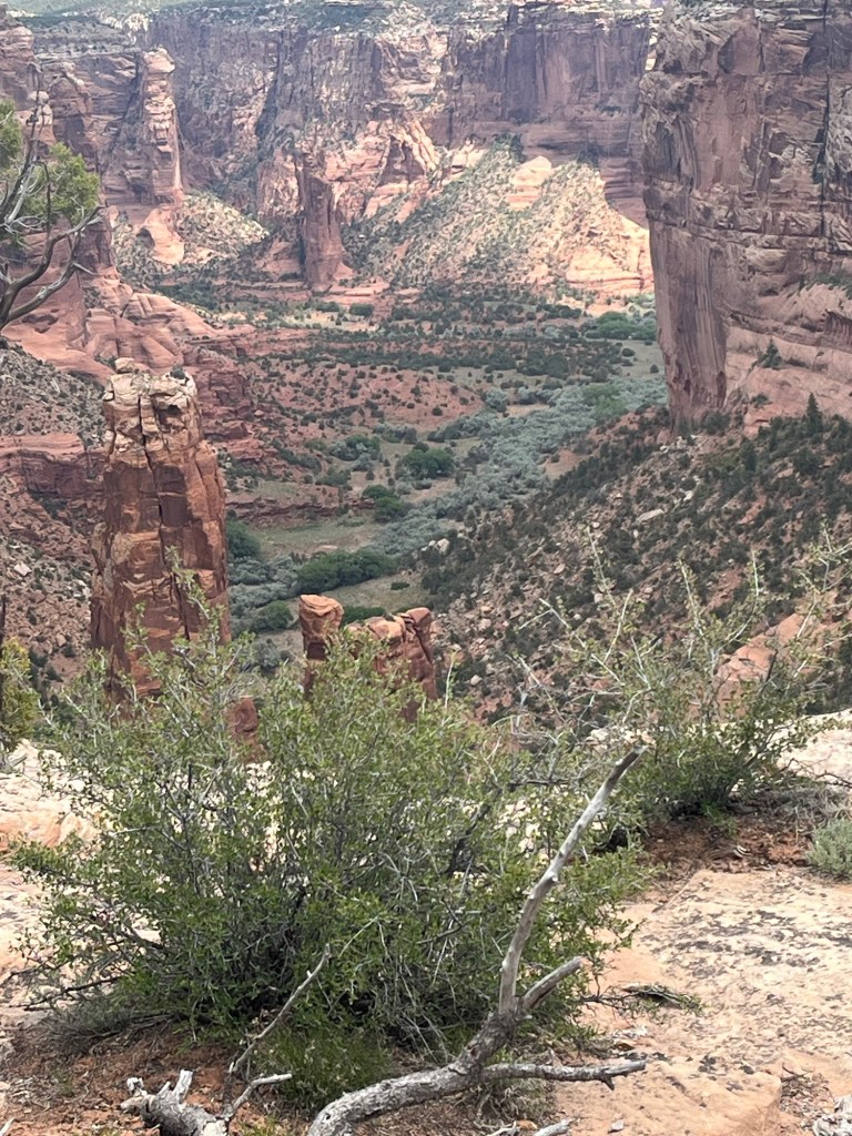
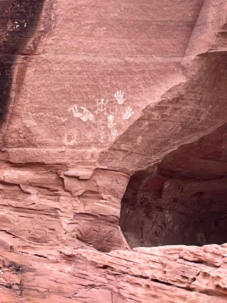
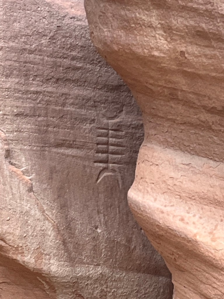
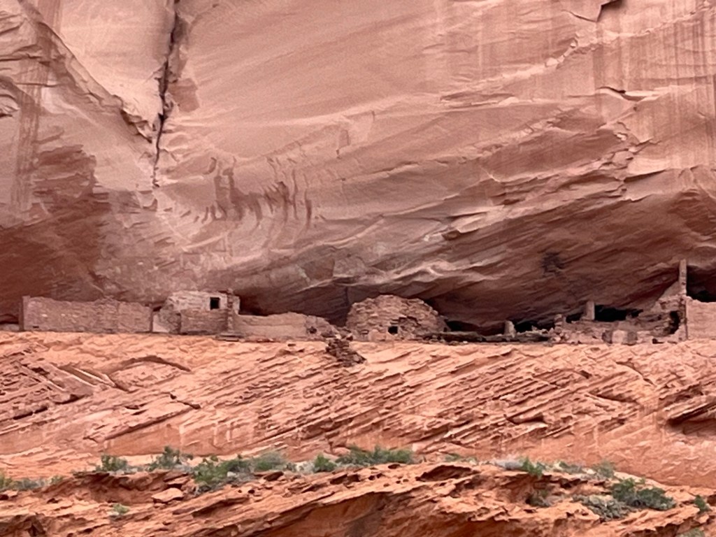
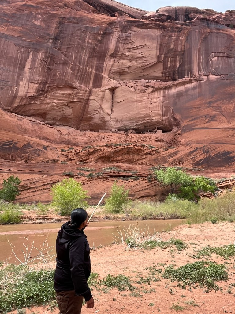
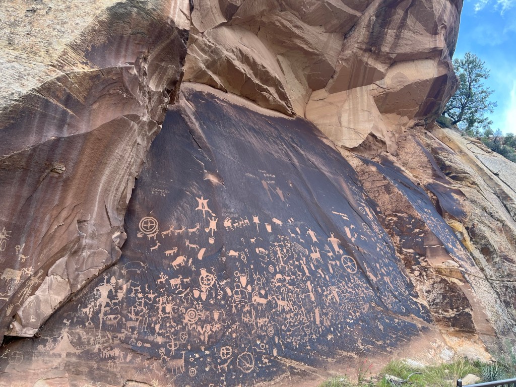
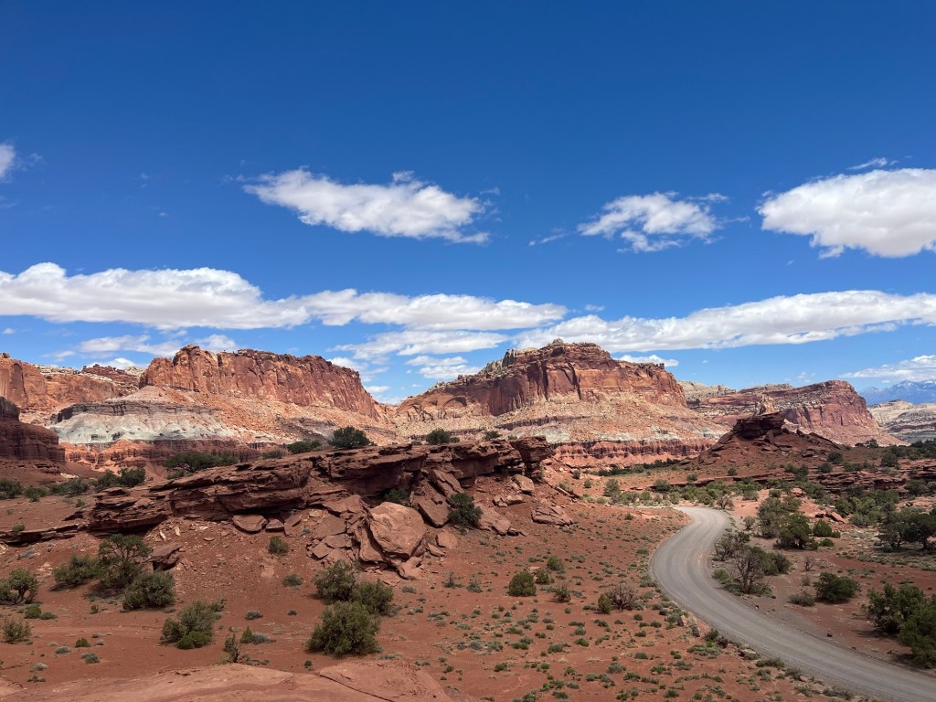
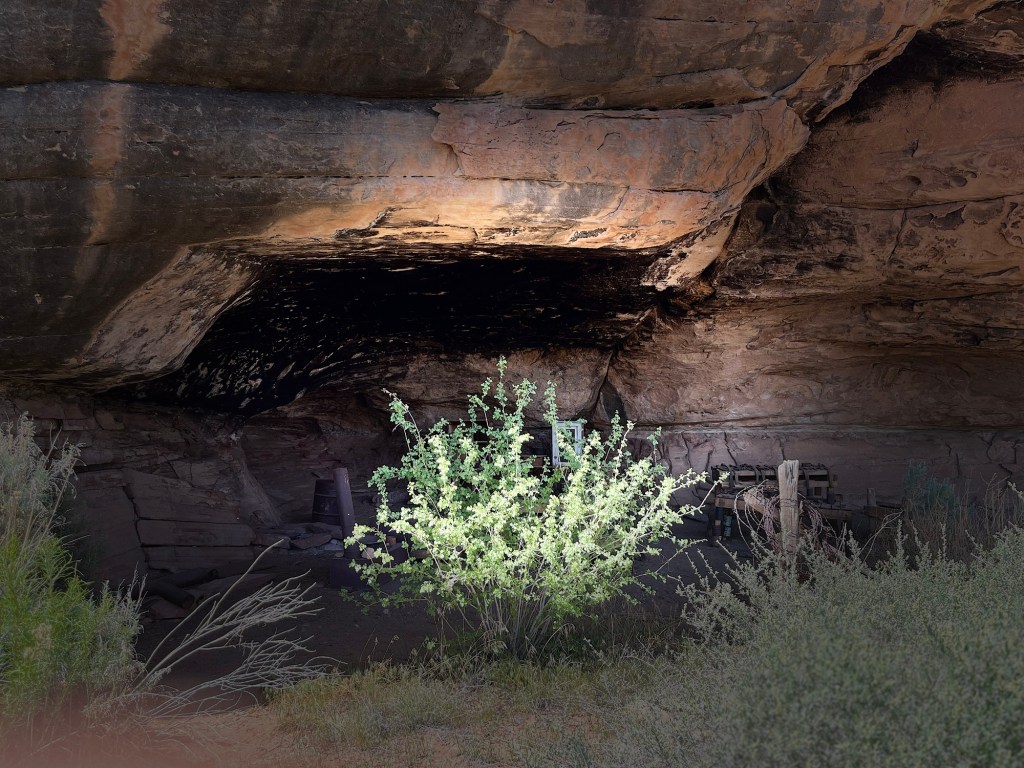
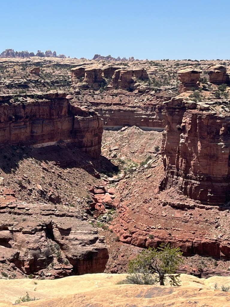
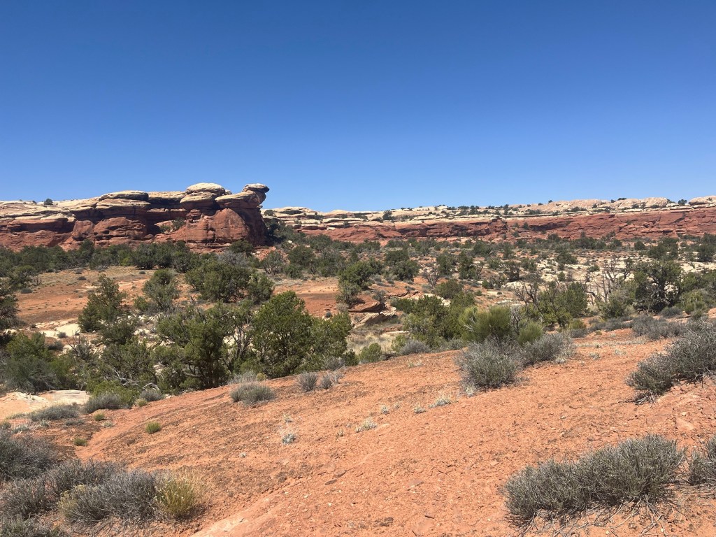
We want to come back to this magical place and spend more time among the ruins and on the numerous hiking trails that we didn’t have time to explore. It’s thought that only about one percent of the dwelling places in this area have been excavated. The Navajo people would prefer that no further excavation be allowed, and I agree. It’s wonderful that we have an opportunity to glimpse a piece of this rich history and fitting that most of it be left undisturbed.

Headed back to Navajo Lake. Every mile is a blessing.

Canyon de Chelly

Friday, May 10-Sunday, May 12

We spent Thursday night in Page, Arizona. Not much to report-it’s near Lake Powell, which we don’t see from our motel room. Friday morning is a lovely drive to Canyon de Chelly (pronounced Chay) National Monument. This is the second largest canyon in the US and is located in the Navajo Nation near the Four Corners region.

On the way to Chinle
The drive is beautiful.
Cottonwood Campground is right behind the visitor center-it’s very quiet and nice to be nestled among the cottonwood trees. We’ve learned that these trees were planted by the CCC to help control erosion in the Canyon, but they are not native and have prevented the growth of other native species such as willows and are therefore being removed in some places.

There are no public trails at Canyon de Chelly, but visitors may drive the rim and there are amazing views from the overlooks. We met some Navajo artists selling jewelry and art at some of the parking lots and had a chance to talk to them and buy some of their work.

This is Spider Rock. Navajo legend says that a Spider Woman lived on top of this rock and would take naughty children up there to teach them how to behave. If those children didn’t learn her lessons, she would eat them! Their bones remain to this day-that’s why the top of the rock is white.

To go into the canyon, visitors must have a guide. The canyon is co-owned by Navajo residents and the Park Service. Guides must be Navajo residents of the canyon.

We decided to take a tour, and we are so glad we did. This is Devonnia, our guide. She took us and 3 other people on a 3-hour tour. She grew up in the canyon with her dad and grandparents. Today, there are about 60 families who own property there, but all except one woman live there seasonally. We discovered the reason for this on the tour. The landowners farm and keep sheep and horses, which are brought out of the canyon during the winter. The Navajo tribe is matriarchal. Land is passed on to the oldest woman in the family. In de Chelly, if there is no heir, the land reverts back to the Park Service.

People have lived in this canyon for 5,000 years. The first inhabitants lived in the cliffs from around 2500 to 200 BCE and left images on the canyon walls to tell their stories. This site is thought to have been a birthing place. Kokopelli, the symbol of fertility, is shown here on his back-representing new life. Between 200 BCE and 750 CE a group called the Basketmakers, named for their weaving skills, began to farm and become more sedentary.

Devonnia pointed out this symbol, which she said was probably left here in the 1940s. It is considered graffiti by archaeologists, but she grew up with its lesson. She drew a picture of it in the dirt and told us the story that her grandmother taught her. It represents the transition from the world into which Navajos are born into the “glitter world” of modern culture. The lines between the two worlds represent culture, language, civility, ego and greed. If younger generations lose their cultural knowledge, their language, and the civility taught by the Old Ones, they will turn to the “me” culture and fall victim to a world of greed and materialism (glitter). Devonnia said she has witnessed the truth of this story in the younger members of the Nation who have fallen victim to drugs and alcohol and have lost their way. As she talked, I felt that this Truth is a truth for all cultures, and I thought about what I was taught as a child- “do not forsake your mother’s teaching,” and other similar Christian scriptures that remind us to hold onto the traditions and the values of our ancestors.

img_3914
Ancestral Pueblos followed the Basketmakers. They are the ancestors of today’s Pueblo, Hopi, and Navajo peoples. These people built multistoried villages and kivas the remnants of which we see today.
img_3915
At some places in the canyon, the walls are more than 1,000 feet tall. Devonnia pointed out several “trails” leading up some of the walls-narrow ledges and ancient carved hand and foot holds. Her grandmother, who is 73 years old, still does guided hikes in the canyon and climbs those impossible- looking trails. We asked Devonnia if she climbed them, and she said, “Yes! I can’t be outdone by my grandmother!”

The canyon becomes impassable at certain times of year, as evidenced by the remains of an unlucky driver. There are no real roads and we were driving through water for much of our trip. We saw markers denoting quick-sand areas. This explains why most families only live there seasonally.

I will always remember this place. Devonnia holds stories that have been passed down in her family for many generations. We feel grateful that she is willing to share them with her guests, and we feel grateful to be welcomed on this land that is sacred to the Navajo Nation and their ancestors.

Moab, Panguitch, and Bryce Canyon National Park, Utah

Sunday, May 5-Tuesday, May 7

We get an early start Sunday and see this along the way.

img_3628
img_3630
There’s something interesting to see around every curve!

We arrive in Moab in time to hang out in town and do some shopping (and laundry-laundromats usually have wi-fi and give us a chance to catch up on correspondence and blogging). Moab is a wide-open kind of town that caters to hikers, campers, off roaders, and all kinds of local characters. It’s crowded, but I like the energy. Gear Heads is a huge outdoor store and we spend some time in there and come out with a new tent. It’s made by Nemo, a company that makes all kinds of camping equipment and offers a life-time guarantee. We’ll post a picture at the next camp site.

I booked a kind of tiny house/room at a place right in town called Kokopelli West.

img_3651

I booked this through Hotels.com because it’s so convenient, but they neglected to send me an email with our door code, so we had no way to get in. This is yet another place with no one on duty; totally self-service. Fortunately, the housekeeping staff helped us by calling the owner and getting the code. I need to stop using these 3rd party services and book directly through the hotels, but anyway…we got in. It was really great to take a shower after 3 days of camping in red dust!

We walked to a Thai restaurant and had a really excellent meal.

img_3653

Monday, May 6

We’re not quite sure where to go next. Arches is nearby, but their campsites are all reservation only and are booked up months in advance. These days you even need an advance ticket to enter the park-that seems like a hassle and when we pass the entrance there is a long line of cars backed up-we keep on going. We do stop by Capitol Reef National Park long enough to take a walk out to an overlook and get some pictures.

img_3679
img_3692

We’re headed to Bryce Canyon National Park and take the scenic route through Escalante. We travel over some very high mountains-with steep drop-offs…we have a knack for finding those curvy roads!

img_3711
Boulder Mountain Summit 9600ft
img_3716
I take a picture about every 5 minutes while Andy is driving…they never turn out very well, but these hundreds of photos help us remember how beautiful and variable this landscape is.

I’m checking the weather for Bryce Canyon and it’s not looking that favorable…a low of 28 and high winds. We’re pretty hardy campers but the wind thing is daunting, so we check into the Bryce Canyon motel in Panguitch, Utah for the right price of $56 a night.

img_3750

It’s a very small town that caters to the Park traffic and has a lot of motels that have been in operation for a long time. There’s an actual person at the desk-her name is Kristen and she has come from her home in Arizona to help out a friend who owns the motel. She’s very friendly and gives us restaurant advice. All of Main St smells like smoked meat as the 2 or 3 restaurants there are barbeque places.

Tuesday, May 7-Bryce Canyon NP

img_3717

We’re coming to accept the reality that visiting the National Parks is not the same as it used to be. This morning the visitor center at Bryce is like the mall at Christmas. We wait in line for some time to talk to a ranger at the information desk about dispersed camping at Zion, where we hope to go next. They only have reserved campsites now so we know we won’t get into their campgrounds, but we hope that the rangers can give us some advice about where to camp outside the park. The rather bored looking person behind the desk says he doesn’t know anything about that-end of discussion.

We’re kind of annoyed and disappointed, but it’s a beautiful day, we’re in the park, and we’re going to take a hike. The Two Bridges/Queen’s Garden combination loop does not disappoint. It starts at Sunrise Point and ends at Sunset Point about 3 miles down into the canyon and back up. It’s pretty easy until the 500ft elevation gain at the end-totally worth it for the views and the beautiful day.

img_3725
img_3730
img_3734
img_3733
img_3738
img_3737

Tonight while we were waiting for a table (and some brisket) at the restaurant, we talked to someone who had just come from Zion. She said it was shockingly crowded. As much as we love Zion and really wanted to go there, we may just skip it. We’ll see what tomorrow brings!

Canyonlands National Park

Monday, April 29-May 2

Canyonlands was one of my favorite parks when we did our last trip in 2017, and I have been looking forward to our return.

80 million years ago, this area was covered by sea, which deposited layers of salt and sand. When the sea receded, the sediment layers were pushed up by tectonic movement and then eroded by water to form a variety of rock formations. What’s left are amazing displays of natural art.

We arrived to find the campgrounds full, which was not a surprise. The great thing about this park is the availability of dispersed camping nearby. The helpful person at the information desk in the visitor center gave us ideas of places to look. The Bureau of Land Management runs several camping locations that provide simple amenities such as pit toilets, fire rings, and picnic tables. We wanted to camp at Hamburger Rock last time, but it was full. Today, we got lucky!

We found the perfect spot under the rocks!

It’s the best campsite ever!

We set up and had time for a short hike that we did last time and really enjoyed. The Cave Spring trail goes past an old cowboy camp and some cave shelters with pictographs.

img_3499
img_3512

The rocks here are amazing.

In the evening, we went to a ranger talk at the campground. Lauren talked about coyotes. They are smart, resilient animals who continue to resist extermination by various private and government agencies. I enjoyed the talk but was distracted by the evening light on the rocks.

My favorite hike in this park is the Slickrock Trail. The path is entirely marked by rock cairns and is a bit of a scramble. The views are 360 degrees and breathtaking.

I felt I was on Holy ground. How could I doubt it? The evidence is undeniable.

Temples

Altars

Baptismal fonts

And the rocks…

img_3544

and of course, the trees!

It was quite windy while we were hiking and Andy was worried about our tent. I kept saying it would be fine, but sure enough, when we got back to our campsite, it had blown over. We were able to re-stake it, but it got some new rips and the zippers were full of red dust (so were our sleeping bags). We got this tent before we were married and I remember telling Andy it was our first joint real estate investment. It’s been from Maine to California and has served us well, but it looks like it’s time for a new one.

On Friday night the 4 wheelers started to arrive. This sport is a big deal around here, and while the National Parks don’t allow off roading, the BLM property is wide open. They raced up and down the dirt road around our campground stirring up dust and making a lot of noise, and also created long lines at the one pit toilet in the campground. We have been previously spoiled by relative solitude and quiet, so this takes some getting used to.

On Saturday we went back to the park and hiked a few miles of the Big Spring Trail. It has some challenging rock , but we managed ok. Saw some magnificent rock formations.

img_3602

Our last hike was the Pothole Trail, an area with many holes and pits in the rock. These holes fill with water after a rain and allow plant growth. Many areas looked as if they had been professionally landscaped. This photo is kind of dull because I had something smeared on my camera lens, but it was a lovely little desert garden.

Canyonlands still rates as one of my favorite places to camp and hike. So glad we had some time there. Next stop, Moab, Utah.